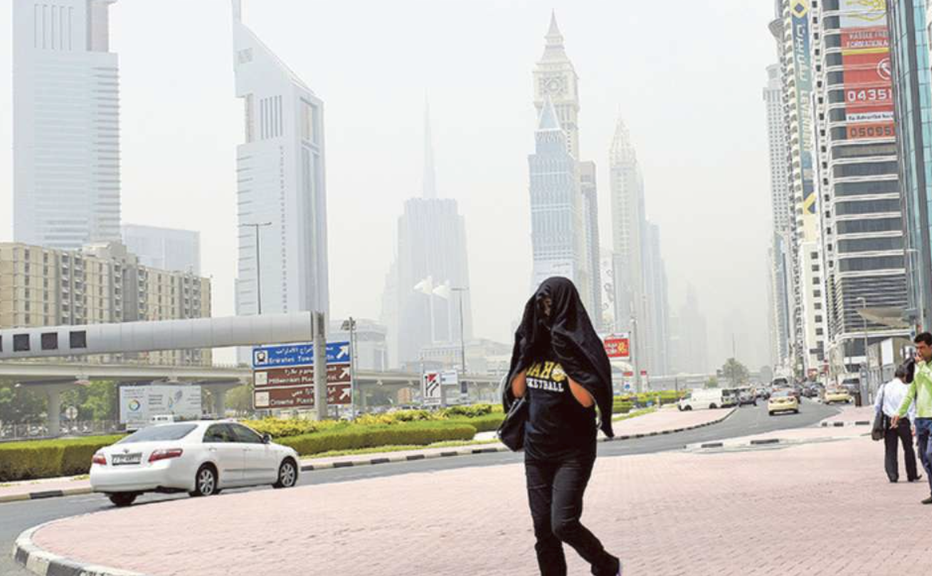
Residents in Dubai woke up on Tuesday morning to unusually dense fog that blanketed much of the emirate, sharply reducing visibility and affecting road and air travel across the region.
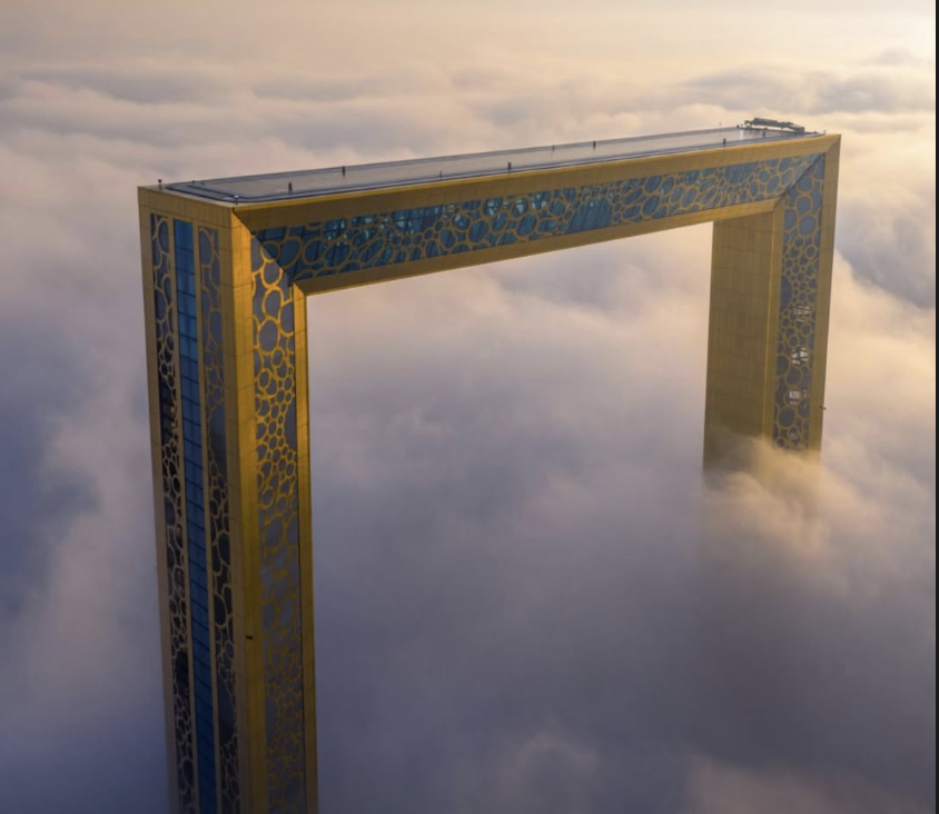
Sheikh Hamdan bin Mohammed bin Rashid Al Maktoum, Crown Prince of Dubai, Deputy Prime Minister and Minister of Defence, and Chairman of the Executive Council of Dubai shared a striking image on his official Instagram account, capturing Dubai’s iconic skyline, including the Burj Khalifa and Burj Al Arab, emerging above a thick layer of white mist as the fog settled over the city. The photograph quickly circulated online, highlighting the dramatic weather conditions.
Sheikh Hamdan’s shared image drew attention to the rare visual phenomenon of Dubai’s skyline appearing almost like an island of skyscrapers above a sea of morning mist, a reminder of the seasonal weather patterns that can occur in the UAE.
Visibility drops and travel disruption
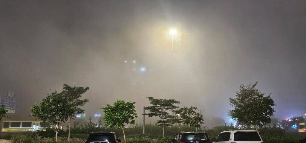
The National Centre of Meteorology (NCM) had issued a visibility warning early Tuesday, with fog expected to linger until around 10am, significantly impacting morning commutes. Heavy fog was reported across Dubai and neighbouring emirates, including Sharjah and Abu Dhabi, with visibility dropping to just a few hundred metres in some areas.
Traffic authorities urged motorists to reduce speed, use fog lights, and maintain safe following distances, as dense patches caused slower-than-usual travel conditions on major routes such as the E311 Emirates Road.
The morning fog also affected travel at Dubai International Airport, where some arrivals and departures were delayed due to limited visibility. Passengers were advised to check the status of flights before travelling to the airport.
According to the NCM’s five-day national forecast, the current alert follows a period of fluctuating temperatures and changing maritime conditions.
While Tuesday is expected to see a rise in temperatures under fair to partly cloudy skies, humidity will build overnight, increasing the risk of mist formation across western coastal regions into Wednesday morning.
On Wednesday, similar conditions are forecast, with overnight and early Thursday humidity bringing a risk of mist in some internal areas. Southeasterly winds will shift north-westerly and freshen westwards by night, reaching speeds of up to 40 km/h. Seas will build from slight to moderate, becoming rough in the Arabian Gulf by night.
Temperatures are expected to ease on Thursday under fair to partly cloudy skies, with inland areas facing a risk of fog overnight into Friday. North-westerly to south-westerly winds may again reach up to 40 km/h. Sea conditions are forecast to remain moderate to rough in the Arabian Gulf, with rough seas developing in the Oman Sea by evening.
On Friday, skies will stay fair to partly cloudy, especially westwards, while rough morning seas are expected to subside gradually.
By Saturday, temperatures will edge up once more under fair to partly cloudy skies, accompanied by lighter winds and slight to moderate seas.
Safety advice and forecast
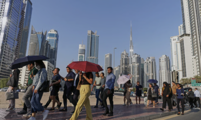
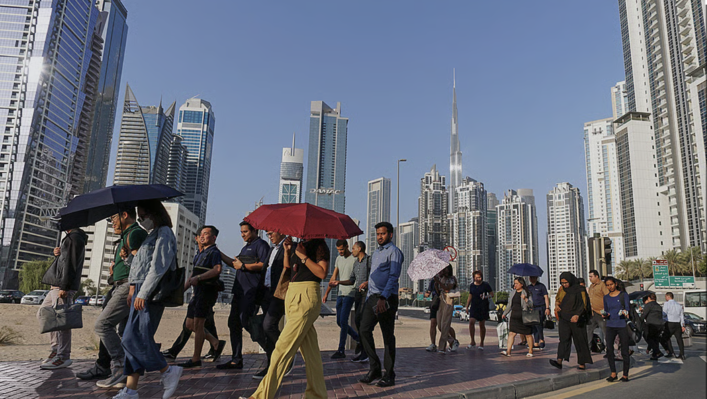
Authorities urged drivers, especially on school bus routes and early commuters, to take extra care on the roads. The visibility advisory is expected to ease as the fog lifts later in the morning, while weather forecasts suggest fair to partly cloudy conditions with rising temperatures throughout the day.
With over 35 years of experience in journalism, copywriting, and PR, Michael Gomes is a seasoned media professional deeply rooted in the UAE’s print and digital landscape.
The UAE is already seeing a taste of summer, with temperatures climbing to 40°C in April, well above the usual seasonal range.
Typically, April temperatures hover between 32°C and 36°C, making this early spike unusual. But despite the rising heat, summer hasn’t fully arrived yet.
The country is currently in the Sarrayat season, a transitional period between spring and summer. This phase, which runs until early May, is known for sudden weather changes, including brief rain, strong winds, and dust storms.
Residents across the country can expect partly cloudy to cloudy skies on April 21, with dusty conditions at times, according to the National Centre of Meteorology (NCM).
There is also a chance of light rain over some coastal areas and islands, along with a slight drop in temperatures, especially in western coastal regions.
Winds will be light to moderate, shifting from southeasterly to northwesterly and northeasterly directions. At times, they may strengthen, reaching speeds of up to 40 km/h, causing dust to blow and reducing visibility in some areas.
Sea conditions will be slight to moderate, becoming rough at times in the Arabian Gulf, particularly toward the west, while remaining slight in the Oman Sea.
City temperatures today:
Dubai: High 35°C-Low 26°C
Abu Dhabi: High 36°C-Low 26°C
Sharjah: High 34°C-Low 22°C
Overall, the UAE continues to experience mixed spring weather, with dust, clouds, and occasional rain ahead of the hotter summer months. For now, the country remains in a transition phase, where heat and rain can occur on the same day, before the full intensity of summer sets in.
Get ready for a bit of everything! The National Centre of Meteorology (NCM) just dropped the latest forecast, and it looks like the UAE is in for a “weather sandwich” starting today through Friday. Whether you’re heading to the office or planning your weekend, here’s the breakdown of what to expect.
The Monday mix: Clouds and cooldowns
We’re kicking the week off with cloudy skies. Keep an eye out for light to moderate rain, especially if you’re along the coast or in the eastern and southern parts of the country. Temperatures are on the rise, and it’s going to get humid tonight. Watch out for mist if you’re driving late.
Tuesday/Wednesday: Dusty and rough
By Tuesday, things stay partly cloudy with a lingering chance of rain in the south. However, the wind is picking up! Expect blowingdust to reduce visibility, and if you’re planning a boat trip, heads up—the sea will get rough by the afternoon.
Wednesday is looking like the peak of the wind. We’re talking stronger gusts that could make driving tricky due to dust, and the Arabian Gulf will be rough to very rough.
CalmThursday/Friday
Good news for the weekend planners. Things start to calm down by Thursday. While it’ll still be a bit dusty, the skies will clear up to a fair to partly cloudy vibe. Seas will settle back to moderate, making for a much smoother end to the week.
Authorities in the UAE have moved to a state of high alert as a persistent low-pressure system brings unsettled weather, scattered rainfall, and dusty winds to the country. The National Centre of Meteorology (NCM) confirmed on Thursday that these conditions are expected to continue through Monday, April 13.
Traffic Safety and Speed Revisions: In a proactive response to deteriorating visibility and slippery road conditions, Abu Dhabi Police have implemented variable speed limits on major motorways.
Safety first on the roads In response to the forecast, Abu Dhabi Police have reiterated the importance of adhering to variable speed limits. These dynamic limits, which drop to 80 km/h during periods of heavy rain or dust storms, are displayed on electronic overhead gantries and are strictly enforced to prevent multi-vehicle accidents.
Motorists are reminded of the strict federal traffic fines currently in place, including a Dh2,000 fine for entering flooded valleys and a Dh800 penalty for using a mobile phone to film weather conditions while driving.
7 fines to watch out for:
Federal traffic authorities have reiterated that safety violations during unstable weather carry heavy penalties. Motorists should be aware of the following strictly enforced fines:
Entering flooded valleys: Dh2,000 fine, 23 black points, and 60-day vehicle impoundment.
Gathering near dams/valleys: To prevent obstruction of rescue teams.
Obstructing emergency services: During weather-related incidents.
Distracted driving: Using mobile phones to film the rain (Dh800 fine).
Misuse of hazard lights: These should not be used while the vehicle is in motion.
Disregarding electronic speed signs: Ignoring the temporary limits displayed on the road.
Unsafe lane changes: Especially dangerous in low-visibility “dusty” conditions.
The weekend outlook
According to the latest NCM bulletins, Friday and Saturday will see conditions similar to those earlier in the week, characterised by intermittent rainfall and freshening winds. These winds are expected to raise dust and sand, reducing visibility.
By Sunday, cloud cover will remain thick, with a continued chance of rainfall. Authorities warn that stronger wind gusts at times could further affect visibility, posing a challenge for motorists. The weather is expected to improve by Monday, with light rain and dusty winds in the afternoon.
The forecast suggests that while Sunday will see continued cloud cover and rainfall, Monday will bring a slight reprieve with light rain. Residents are encouraged to download official apps for real-time updates and to prioritise safety during their commutes.